
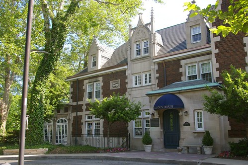
Glidden House (built 1909). 1901 Ford Drive.
When I look at the buildings that make up the area we now call University Circle, I tend to assume that the area was laid out and built in the 1900s and 1910s. Indeed, save for some buildings on the campus of Case Western Reserve University, there aren't any structures built much before this time.
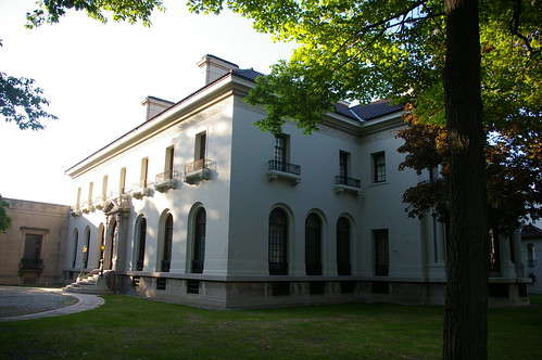
The houses that haven't been replaced by newer buildings tend toward grand mansions - like the Hay-McKinney House - one of the structures occupied by the Western Reserve Historical Society.
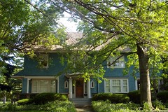
Even the (relatively) smaller houses, like this pair on Magnolia Drive, seem quite suited to the flow of the boulevards.
Imagine my surprise when I learned that a good portion of the roads we use today were laid out a good 30 years before these houses were built.
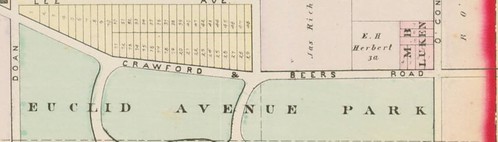

Details of the 1874 D.J. Lake Atlas of Cuyahoga County, Ohio, used courtesy of Cleveland Public Library.
Jeptha Wade began developing his farm into a park (Wade Park) in the early 1870s. These details show the layout of the roads within the park as they were in 1874. The map is bounded by Euclid Avenue on the south, East 105th Street on the west, East 115th Street on the east, and Ashbury Avenue on the north. Note how similar the layout of these roads remain to the streets present in the University Circle area today. Perhaps they're part of the reason why the area has managed to retain something of a park-like presence.
Very interesting Christopher. For those that don't know the area as well, a contemporary map side by side with the historic one, or an overlay of the two together, would be helpful to see just how well the streets align.
ReplyDeleteDaniel: Check out three overlays on the Bluestone Heights blog: http://bluestoneheights.org/bsh/2012/03/28/wade-park-1874/
DeleteIt was layed out as a part of the Boulevard movement as started in Paris in the 1880's -1900's. See the City Beautiful proposals ie Burnham Plan etc. Much of University Circle was defined during the period of the Euclid Ave mansions and influenced by Jeptha Wade and Wm Mather including the appearance of Western Reserve College from Hudson.
ReplyDeleteThe park-like meandering streets in the North Campus area of CWRU are very similar to this map, except that since then Ford was extended to Euclid (through the Horace Ford land) and Magnolia was disrupted (to build WRU residence halls in the 1960s) and so the section of Magnolia that now includes the Alumni House, Coffee House, and the side of Glidden House...that section of the street was renamed to be part of "Juniper." Addresses of those houses way-back-when were on Magnolia.
ReplyDeleteThose 1960s residence halls are getting close to the end of their planned lifespan. Perhaps one day the university will bring back that section of Magnolia.
On another note... E. 115th is labeled O'Connor on this map. Ah, the fancy CWRU student housing complex, "The Village at 115" could have been "The Village on O'Connor"!
Very interesting, Christopher. Currently I'm researching Florence Brown Finn Bratenahl of the Alexander E Brown family. After the death of her first husband, the Rev Francis T H in 1913, Florence moved in with her brother, Alexander C Brown, at 1625 Hazel Avenue. Google puts that address in the parking lot behind the Hays Mansion. Do you have an old map that shows what might have been there in the early 1900s?
ReplyDelete