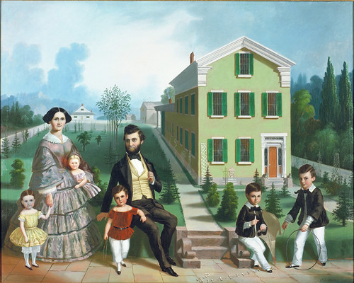
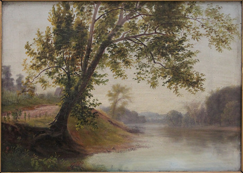
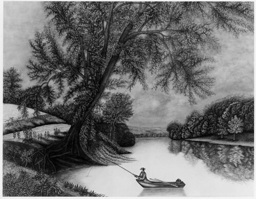
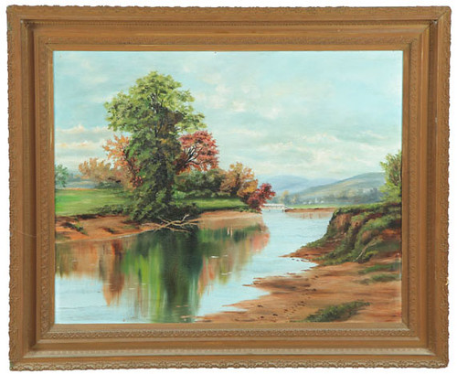
The Bentley Simons Runyan Family of Mansfield, Ohio an oil painting (circa 1857) by Frederick Elmore Cohen. 38 x 45 in. Used courtesy of the Allen Memorial Art Museum.
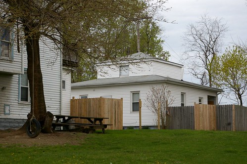
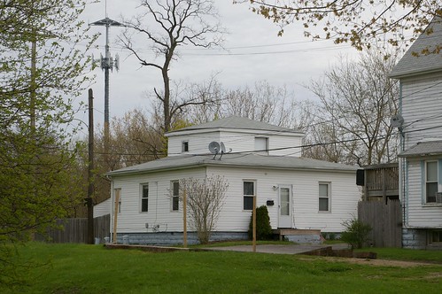
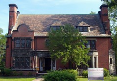
Last week, I shared the location of this, the house depicted in one of my favorite Ohio paintings. Today, I'll illuminate something of the house itself and the people who lived there. In part three, next week, I'll bring everything together and provide some analysis as to what it all means.
Boyd Addlesperger, local history librarian at the Mansfield / Richland County Public Library, was kind enough to email me with a copy of the following article. Esther Smith (Many Notables Walked Between Iron Lions of Former Cappeller Home on West Fourth, Mansfield News Journal, July 20, 1941) provides a wonderful history of the house and the families who lived in it. I've inserted several historic maps to help illustrate the changes to the propery. Note that in the maps, the front of the house is at the top of the image. My commentary is in italics.
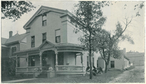
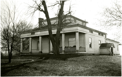
For almost a century the doorway at 93 West Fourth street has been guarded by a pair of crouching cast-iron lions. They were placed there when the big brick house was built by Bentley Runyan who came to Mansfield from Knox County in 1847. State and national figures have passed between them.
Three Ohio governors, Joseph V. Foraker, George K. Nash and Asa Bushnell were frequent visitors at the home during the 25 years it was occupied by William S. Cappeller, publisher of Mansfield's first daily newspaper and prominent figure in Ohio Republican life.
Warren G. Harding was entertained there during his campaign for presidency of the United States and John Sherman often called at the Cappeller home.
One of the showplaces of the city at the time it was built, the old Runyan home was for several years the only house that stood in that particular block on the south side of West Fourth Street.
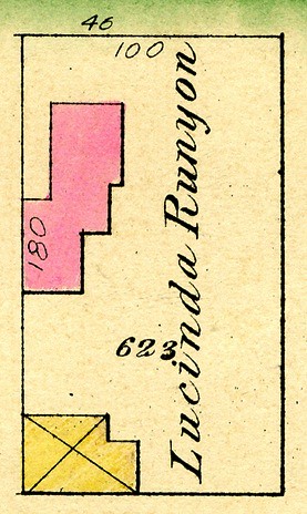
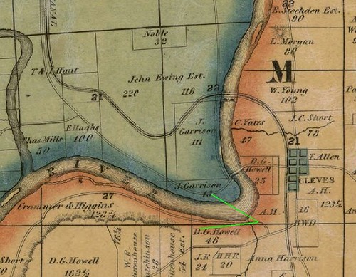
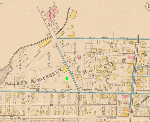
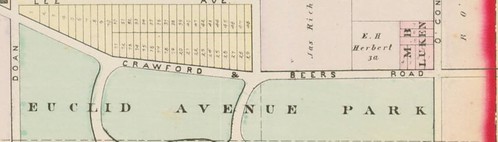
[detail] Plate B - Parts of Wards 1, 2, and 3, Atlas of the City of Mansfield, Ohio. E. Robinson & R.H. Pidgeon, Civil Engineers. Published by E. Robinson, New York, 1882. Used courtesy of Richland County, Ohio USGenWeb.
The lot is seen here in 1882. The brick house, shown in Cohen's painting, is in red, while the barn, to the rear, is in yellow. Note that the lot remains empty of other structures.
Commodious rooms prevailed throughout the house and the downstairs boasted both a parlor and sitting room, bedroom, a dining room that ran the width of the house, kitchen and pantry besides the various extensions that served as woodshed and ice house.
Upstairs there were a series of bedrooms making a total of 14 rooms throughout the entire house.
Numerous changes have been made in the house since then but one feature that remains the same, a beautiful spiral staircase that extends from the reception hall to the third floor. As unique in local architecture today as it was originally the staircase has a narrow walnut banister supported by a newel post and slender spindles whose fragile appearance belies their sturdiness.
As long as the Runyan family occupied the house few changes, if any, were made, according to Mrs. George A. Mead, 65 Blymyer avenue, a granddaughter.
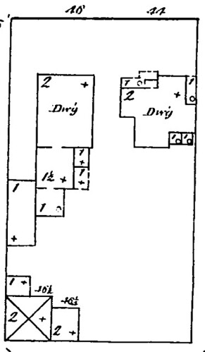
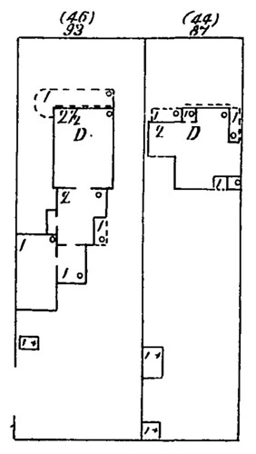
[detail] 1887 Sanborn fire insurance map of Mansfield, Ohio. See also: the full map.
While the residence and carriage house remained essentially unchanged, the lot was split in two by 1887. The area shown as the garden in Frederick Elmore Cohen's painting had a house sitting on it by the time this map, published in 1887, was printed.
Residence of W.S. Cappeller, No. 93 West Fourth Street. Reproduced from The County of Richland, Ohio (1896). Published by Rerick Bros., Richmond, IN. Used courtesy of the Richland County Historical Society.
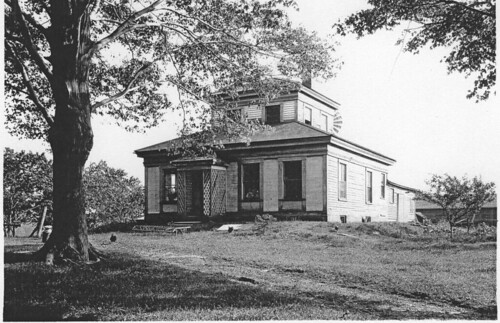
The facade was first altered during the occupancy of the Cappeller family by the building of a verandah that gave an added appearance of width to the front of the dwelling.
An oil painting of the home and Runyan family at the time the children were small now hands in the home of a granddaughter, Mrs. James McCullough in Oberlin. A photograph of the painting is in Mrs. Mead's possession.
The house was kept in the Runyan family until the two sisters, Miss Mary Ellen Runyan, who had established the first private kindergarten in Mansfield, and Mrs. Almeda Parsons and the latter's infant daughter, now Mrs. McCullough, were the only occupants. Mrs. Parson's husband had recently died and she and her sister sought a more compact dwelling.
W.S. Cappeller and his family came to Mansfield from Cincinnati in 1885 while Cappeller was commissioner of railroads in Ohio.
[detail], 1897 Sanborn fire insurance Sanborn map of Mansfield, Ohio. See also: the full map.
Early in the residency of the Cappeller family (by 1897) the barn to the rear of the lot was removed.
Scene of many social gatherings from the senior Cappeller's political and public life, the home for the next 25 years was also a gathering place for the friends of the sons and daughters.
There were three grown children at home then, William G. Cappeller, now dead, a bookkeeper in his father's Daily News; a daughter, Nora, now the wife of W.M. Congwer of Cleveland, and E.B. Cappeller, then a student at Cornell university and now living in Cleveland.
Antique furnishings were used throughout the house, Mrs. Flora G. Cappeller, 111 Sherman avenue, widow of W.G. Cappeller, recalls. Two choice pieces, belonging to her husband's grandmother, Mrs. Mary Cappeller, a dresser and a chest, are now in her possession, and also the silver water chariot that was presented to W.S. Cappeller at the time he retired as treasurer of Hamilton county.
In 1911 W.S. Cappeller died and his widow dismantled the home and went to Cincinnati to live with a daughter, Mrs. Laura Doran, now a resident of California.
Since that time the house has been occupied by a Mansfield physician, Dr. D.W. Peppard and his family.
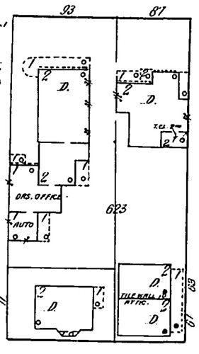
[detail], 1914 Sanborn fire insurance map of Mansfield, Ohio. See also: the full map.
Between 1909 and 1914, the lots were split up, and new houses were built on the rear half of the lot. By 1921, a garage had been added to the lot of the house behind the Runyan house. No further changes to the footprints of the structures show up on the 1929 or 1949 Sanborn fire insurance maps.
More extensive improvements have been made by the Peppards than in any year prior to their occupancy. Additional windows have been installed to let in more sunlight. New fireplaces have been built in practically all of the downstairs and upstairs rooms that were originally equipped with mantels.
Part of the space in the large dining room has been appropriated for a modern kitchen while a rear screened-in porch with a floor has been built to the east for an "outdoor" dining nook where every meal in the summer time is a picnic, Mrs. Peppard said.
Dr. Peppard's office now occupies the extension that was formerly the old Runyan woodshed and that now runs along side Cappeller court.
Seldom has there been a time in the history of the house that there have not been young people in it. The Peppards reared a son and three daughters there and it was only this summer that the last of their children, William D. Peppard, married and moved to his own home.
Be sure to tune in next time, for the final part of this story, where I'll make some sense of everything that's been revealed about this family and the place they called home.
![[detail] Bentley Simons Runyan Family of Mansfield, Ohio](http://farm9.staticflickr.com/8353/8268888278_3376f28c17.jpg)
![[detail] Plate B - Parts of Wards 1, 2, and 3](http://farm9.staticflickr.com/8354/8265929952_243a27536b.jpg)
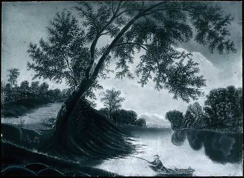
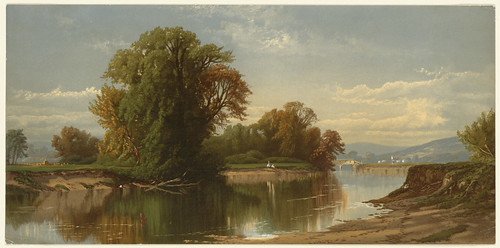
![Mill Creek Near Cincinnati / [less likely ] Great Miami River near Cleves](http://farm8.staticflickr.com/7265/7456187278_6bd4aec4a3.jpg)
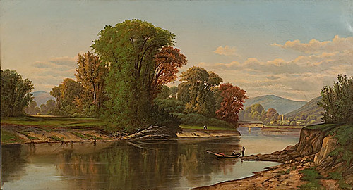


![View on the Miami River [ now the Maumee River, probably at or near Fort Miami ]](http://farm9.staticflickr.com/8483/8230454680_3e464def18.jpg)

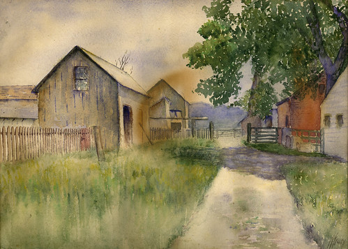


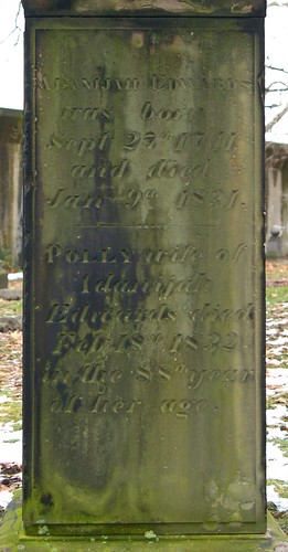
![? [Edwards family plot]](http://farm5.staticflickr.com/4131/5198901762_77f890fb02.jpg)
![Currier, Sarah [top of marker]](http://farm8.staticflickr.com/7023/6508072717_a5e69288f6.jpg)