or: Identifying the Region's Oldest Houses.
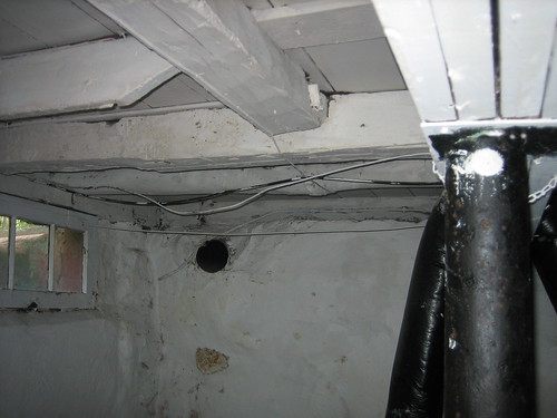 Photo by Laura Howard
On numerous occasions, I've been asked to help figure out how old this or that house is. More often than not, these questions come from the residents themselves. While it is possible to learn quite a bit from historical records, this can require specialized knowledge and still leave one with only a range of dates.
Homeowners (and other residents) are in a unique position to help date a structure - they have full access to the house, and can learn everything that the structure might tell them.
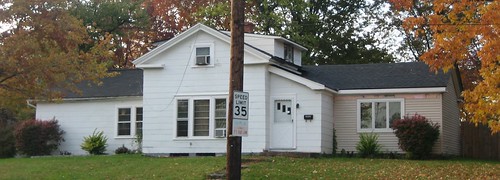 Photo by Laura Howard
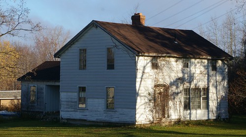
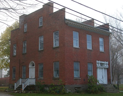
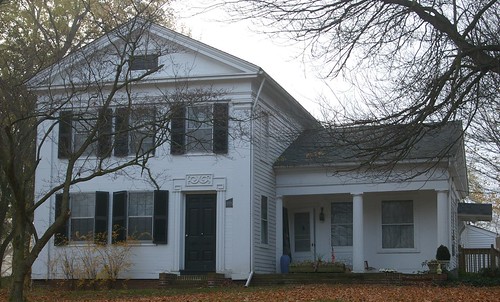
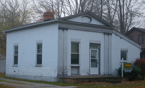
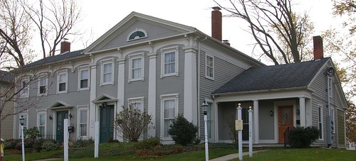
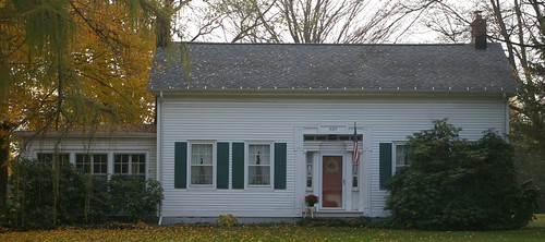
Today, I will illustrate what we can learn from the physical evidence present at 5856 Pearl Road, in Parma Heights, Ohio. This historic home was photographed by Laura Howard, about a year and a half ago, and she was kind enough to share the photographs with me.
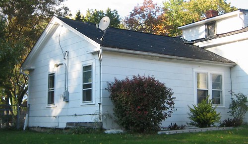 Photo by Laura Howard
The oldest part of the house, the southwest wing, is said to have been built by Oliver Emerson in 1831.
The exterior has been heavily modified. Other than the basic proportions, little original detail remains to be seen here. The original wood siding has been covered by asbestos shingles, and the window openings have likely been moved. Dormers have been added to the center wing of the house. The location of the center window on the second floor is likely original, but beyond that, I can't be sure of much without further physical investigation.
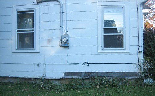 Photo by Laura Howard
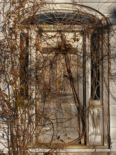
The one spot where the wood siding is exposed, alas, does not provide much detail for us to work with. Likewise the foundation, which appears to be made of material consistent with the suggested date, is sufficiently concealed that we can't learn much. There isn't a basement under this portion of the house, which is consistent with an earlier construction date.
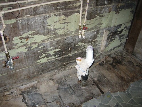 Photo by Laura Howard
Inside this part of the house, the north wall includes this wood paneling.
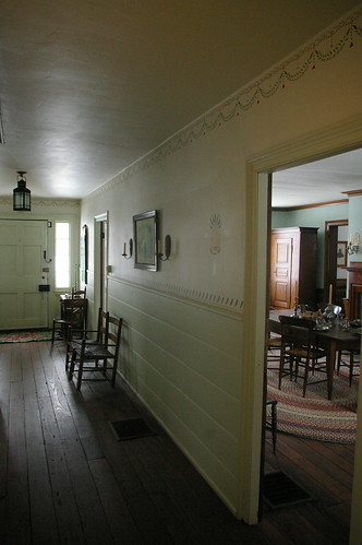
It is consistent with the paneling installed in the front hall of the Dunham Tavern. It's unclear whether this was installed at the time of construction or later. This could be determined by the careful removal of said paneling - if there is evidence of plaster underneath, it would indicate that the wood was added later.
The wide, thick floors, without use of subflooring would also tend to be indicative of an earlier date of construction.
The house retains
a central fireplace. Unfortunately, it appears to have been modified so extensively that I can't tell much about it. I suspect that underneath the current brick may be the original fireplace. If this is, in fact, the case, this would tend toward indicating an early construction date, as with time and wood stoves, the trend was toward fireplaces on the ends of the structure.
 Photos by Laura Howard
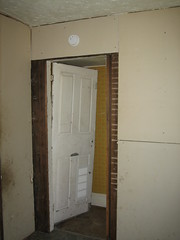
The wall between the south and center parts of the house has been covered with drywall, concealing or eliminating much of the structural evidence. The door on the left, to the basement, is consistent in style with something built in the middle third of the 19th century, but beyond that, it's hard to be sure. It could be later, too.
If we look at the doorframe on the left, we can see, on the right side, the horizontal white lines where the plaster spread through the lath. At the bottom, there is an area that is free of such markings, suggesting that wood paneling may have been present originally.
 Photos by Laura Howard
The center part of the house reveals more detail. In this photo of the basement, as well as in the lead photo, we can see hand-hewn timbers, indicative of a very early construction date. Cutting lumber was incredibly labor-intensive, and sawmills were set up anywhere that there was sufficient water to operate them. As a result, hand-hewn timbers are indicative of some of the earliest houses in the region. Further, as this part of the structure is one of the most difficult elements to change, this can help us date a house even when much of the original detail is missing.
One might also note that the subflooring (or possibly flooring) appears smooth in this image, suggesting that it was either replaced, or that the hand-hewn timbers we see here were reused from another structure. Note also the various shapes the timbers were hewn into.
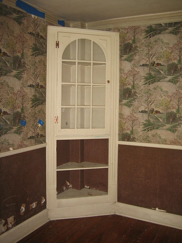 Photo by Laura Howard
On the first floor of the main wing, at one of the front corners is this corner cupboard, probably added circa 1910-1930. Behind it, we can see a structural timber, which would not have been common in a later structure.
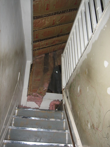 Photo by Laura Howard
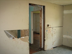
The stairs to the second floor reveal more structural details. We can see the outlines of the structural timbers that make up the top of the wall and the corner. We can also see a line on the wall, above the stairs, at a steeper angle than the stairs currently have. I found this rather suspect.
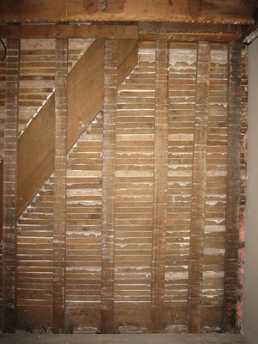 Photo by Laura Howard
This photograph, of the wall opposite the right side of the stairs, helps reveal what we see here. The steeper diagonal lines are the original stringers - the structural boards that make up the sides of the stairs. Why they were left in when the staircase was rebuilt at a more comfortable angle is unclear.
This photo provides a closer detail of the structure.
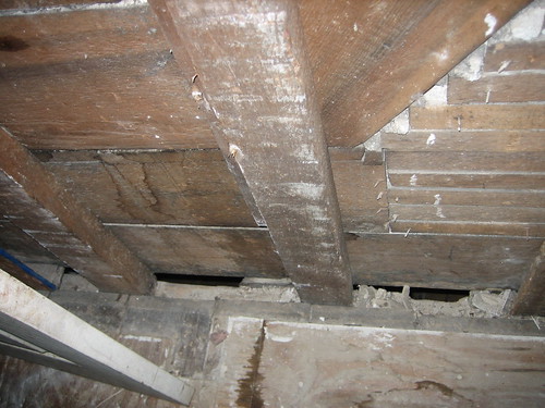 Photo by Laura Howard
This view, at the bottom of the stairs, on the same wall, suggests that there was wood paneling, similar to what is visible in the older part of the house, that may have been concealed by drywall or plaster.
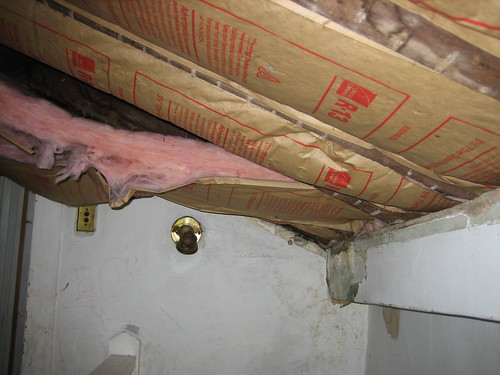 Photo by Laura Howard
Here, at the top of the stairs, we can see with more detail the massive timbers that make up the frame of the house.
There are
many more details that I've omitted simply because I lack the information or detail to make full sense of them.
How old is this house? It's hard to say. It's believable that some part of the physical fabric dates to 1831, but how much is unclear. There's still a lot of research to be done in the history of buildings in this area.
If you have a house with structural hand-hewn timbers, please let me know. I'd be interested in better documenting and understanding the construction methods. It would help increase our knowledge of the early history of northeast Ohio.