Showing posts with label Cuyahoga County. Show all posts

Wednesday, February 13, 2013

New Find! First* Painting of Cleveland in Color!

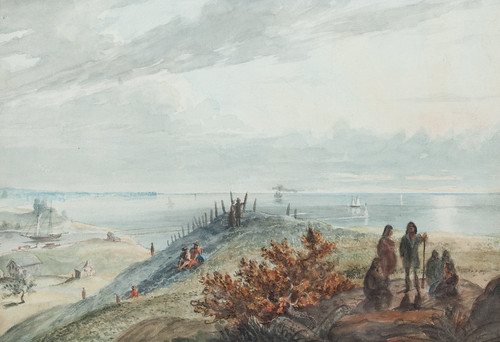
Lake Erie, From Cleveland
Lake Erie, From Cleveland. A watercolor painting (July, 1833) by Seth Eastman. Used courtesy of Sloans and Kenyon Auctioneers and Appraisers, Bethesda, Maryland.

When I think about downtown Cleveland and the mouth of the Cuyahoga, images of industry and commerce come to mind. While I know it wasn't always this way, this area has so long been the heart of the city it's hard to imagine it otherwise. Even Thomas Whelpley's four views of the city, published in 1834, show a quickly-growing city.

It's for that very reason that this watercolor, made by Seth Eastman in July, 1833, is so special - it represents the earliest detailed painting I'm aware of of the mouth of the Cuyahoga River.

Eastman probably came through Cleveland en route from Fort Snelling, in Minnesota, to West Point, New York, where he had received a teaching appointment. He appears to have been looking west from what is now the intersection of West Sixth Streets and Lakeside Avenue.

In the foreground, to the right, there's a group of five Native Americans, said to be Iroquois. A few people sit on the hillside, where a row of fenceposts is visible. Closer to the river are a couple of buildings, one of which appears to be a log house. On the river, there are what could be canal boats. The pier and harbor light are also present. The hill at the mouth of the Cuyahoga, on the west bank, had not yet been flattened. A steamship, with a cloud of black smoke, sails on Lake Erie. In the distance, we see what would come to be called the "Gold Coast."

These things are all significant.

There are almost no historic images of Native Americans in Ohio. Of those, virtually all were either made years after the fact, based on memory and conjecture or were made by artists who hadn't seen the people in question. I can't think of another painting (within the scope of my current research - before 1866) that documents Native Americans in Ohio at the time the painting was made.

The presence of a log building is also notable - there are very few known in northern Ohio. While there were a good number built (though not in such numbers as in the southern part of the state) they would have usually been covered with siding as soon as was practical, as a matter of fashion and appearance.

Further, this painting documents Cleveland at a point just before it underwent a major transformation. With the completion of the Ohio and Erie Canal, Cleveland and the interior of Ohio were opened up to commerce. The cost of shipping goods dropped considerably. Cuyahoga County's population would more than double between 1830 and 1840. It would almost double again by 1850. The landscape illustrated here would soon be gone.
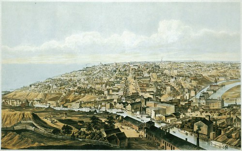
Cleveland, 1853
Cleveland, 1853 A hand colored lithograph (1853) by B.F. Smith, after a drawing by J.W. Hill. Published by Smith Bros. & Co. Used courtesy of the Chicago Historical Society. Reproduced from Bird's Eye Views: Historic Lithographs of North American Cities by John W. Reps.

This view, made 20 years later, from the west bank of the Cuyahoga, looking east, shows the magnitude of the change. While the west bank still has plenty of vacant land, the east side and downtown are mostly built up. Warehouses line the banks of the Cuyahoga River. To the right, we see both the Cuyahoga River and the narrower Ohio and Erie Canal.
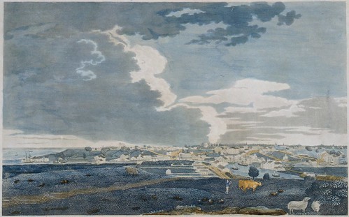
Cleveland, Ohio, From Brooklyn Hill Looking East
Cleveland, Ohio, From Brooklyn Hill Looking East. A hand-colored etching (1834) by Thomas Whelpley. Engraved by Milo Osborne. Used courtesy of Cleveland Public Library.

The point from where Seth Eastman made the watercolor is illustrated in this 1834 print, Cleveland, Ohio, From Brooklyn Hill Looking East.
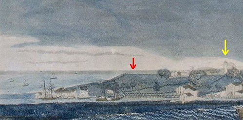
Whelpley detail
Detail, Cleveland, Ohio, From Brooklyn Hill Looking East. A hand-colored etching (1834) by Thomas Whelpley. Engraved by Milo Osborne. Used courtesy of Cleveland Public Library.

This detail, taken from the left side of the print, illustrates the location more clearly. Eastman's vantage point is indicated by the red arrow. Note the row of fenceposts, illustrated in the painting, to the left of the arrow. The yellow arrow indicates the location of the Cleveland lighthouse.
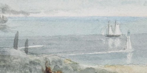
Harbor Light
Detail, Lake Erie, From Cleveland. A watercolor painting (July, 1833) by Seth Eastman. Used courtesy of Sloans and Kenyon Auctioneers and Appraisers, Bethesda, Maryland.

It's worth noting the presence of the harbor light, at the mouth of the Cuyahoga River. This structure was likely completed a year or two earlier.

[Cleveland harbor]
[Cleveland harbor] A print (1837) by Charles Whittlesey. Published in the Annual report on the geological survey of the State of Ohio (1837). Used courtesy of Ohio State University and the Internet Archive.

The pier upon which the harbor light was built is illustrated, top and center, in this drawing - letter "F". There's a square, on the right (east) side of the river that provided the foundation for the structure.
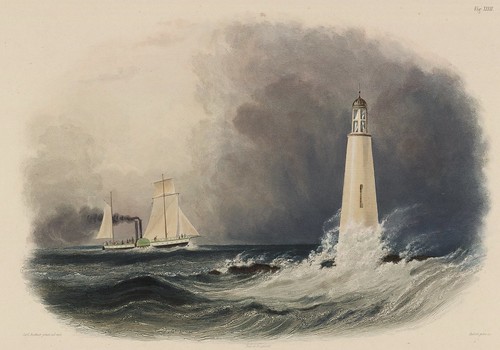
Cleveland Lighthouse on the Lake Erie
Cleveland Lighthouse on the Lake Erie. A hand-colored engraving (1839) by Pierre Eugène I. Aubert, after a drawing by Karl Bodmer. Published in Reise in das innere Nord-America in den Jahren 1832 bis 1834 (1839) by Maximilian Wied. Used courtesy of the Beinecke Library, Yale University.

I've often heard suggested that this 1839 print, based on preliminary drawings and/or paintings made in 1834, doesn't actually portray the Cleveland lighthouse. What then, I ask, does it portray? The response tends to be a mumble that it's probably somewhere else.

It's been pointed out that the structure in the print doesn't look like the Cleveland lighthouse, nor is it located up on the hill like the Cleveland lighthouse was - see the point noted by the yellow arrow above.

Seth Eastman's painting, combined with Charles Whittlesey's map of the harbor seem to indicate that Karl Bodmer's print, Cleveland Lighthouse on the Lake Erie, does, in fact, depict a Cleveland scene. It's just that the structure being illustrated isn't the lighthouse but rather, the harbor light. Perhaps this was a translation issue.

Bodmer's vantage point appears to have been from the west bank of the Cuyahoga. It's worth noting that the physical relationship between the ship and the harbor light appears to be about the same in Seth Eastman's painting and Karl Bodmer's print. What does this mean? I do not know.
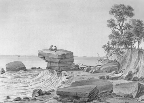


View of Inscription Rock on South side of Cunningham Island, Lake Erie
View of Inscription Rock on South side of Cunningham Island, Lake Erie. A print (1852) The print is based on a drawing by Seth Eastman created in 1850.
C. E. Wagstaff & J. Andrews (Engraver) Published in Historical and statistical information respecting the history, condition, and prospects of the Indian tribes of the United States; collected and prepared under the direction of the Bureau of Indian Affairs per act of Congress of March 3rd, 1847, Volume 2 (1852) by Henry Rowe Schoolcraft. Image used courtesy of the Ohio Historical Society.


Seth Eastman is best known for the work he did portraying Native Americans - the greatest bulk of which appeared in Henry Rowe Schoolcraft's Historical and Statistical Information, Respecting the History, Condition and Prospects of the Indian Tribes of the United States, published in the 1850s. This view of Kelley's Island is one such image.
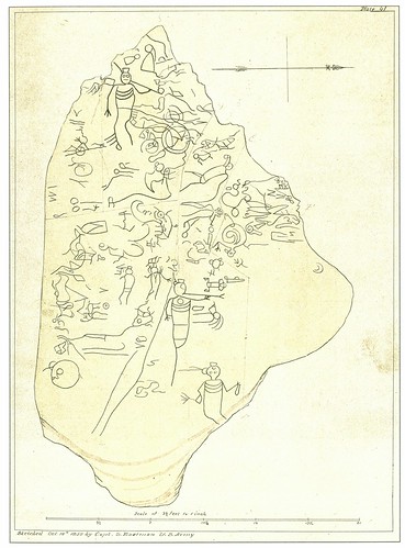
Sculptured Inscriptions on Rock, South Side Of Cunningham's Island, Lake Erie
Sculptured Inscriptions on Rock, South Side Of Cunningham's Island, Lake Erie. A pen and ink drawing (October 10, 1850) by Seth Eastman. Reproduced from Seth Eastman: A Portfolio of North American Indians (1995) by Sarah E. Boehme, Christian F. Feest, and Patricia Condon Johnston.

His record of Inscripion Rock on Kelley's Island, the original drawing for which is shown here, remains the best document that we have of this important, but now rather eroded, pictograph group.
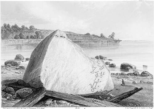
Inscription Rock, North Side of Cunningham's Is., Lake Erie
Inscription Rock, North Side of Cunningham's Is., Lake Erie. A print (1852) by Seth Eastman, from a sketch made October 12, 1850. Published in Historical and statistical information respecting the history, condition, and prospects of the Indian tribes of the United States; collected and prepared under the direction of the Bureau of Indian Affairs per act of Congress of March 3rd, 1847, Volume 2 (1852) by Henry Rowe Schoolcraft. Used courtesy of Cornell University Library and the Internet Archive.

Another boulder, now lost, inscribed with pictographs was present on the north shore of Kelley's Island, near the present state park campground.

Eastman's documentation of the island also included two earthworks.
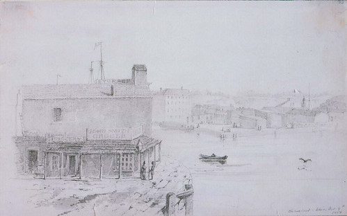
Cleveland, Ohio Grocery Store
Cleveland, Ohio Grocery Store [John Smith Grocer]. A drawing (October 9, 1850) by Seth Eastman. Used courtesy of the Museum of Fine Arts, Boston.

In the course of his travels, Seth Eastman made drawings of the cities he passed through, along with other items not relating to the subject of his research. The Museum of Fine Arts, Boston, has drawings by Eastman of Fairport Harbor and Sandusky, in addition to this one, of a grocer on the Cuyahoga River, in Cleveland.

After the initial discovery of this painting wore off, I started to suspect that the watercolor painting, Lake Erie, From Cleveland, might have been made in the 1850s, based partially on his observations in the 1830s. I couldn't locate any works this early by Seth Eastman, and the combination of factors in this painting - the portrayal of the landscape and the presence of Native Americans, among others - just seemed too good to be true.

So I did more research. I found that the layout of the harbor is consistent with Cleveland in 1833. The number and nature of buildings corresponds reasonably with Whelpley's print of a year later. And the improvements made in the 1840s are not present. Further, the technique of the painting is not as refined as Eastman's later works.

I'm confident, now, that Lake Erie, From Cleveland depicts Cleveland in July of 1833. It provides a rare glimpse into the landscape of this region as it used to be.

This watercolor is to be auctioned at Sloans and Kenyon this Sunday. Their estimate is $80,000-$150,000 - meaning that the bidding will likely start at $40,000.


* The Seth Pease 1796 map of Cleveland (see a drawing based upon said map) features a tent with a couple men situated by the mouth of the Cuyahoga River. However, this appears, to my eyes, to be merely added as a visual device, rather than an attempt to illustrate the location. For that reason, I don't count it as a painting of the city.

Correction: Janice B. Patterson, author of Cleveland's Lighthouses, pointed out to me that where I said "breakwater", I meant "pier". I corrected the two instances of this term. She noted that "There were no breakwaters in the 1830s -- they were built in the 1870s. I think what you are calling a breakwater was actually just a wooden pier, built on pilings and possibly reinforced with stones."

Wednesday, December 15, 2010

Does Your Basement Look Like This? I want to know!

or: Identifying the Region's Oldest Houses.

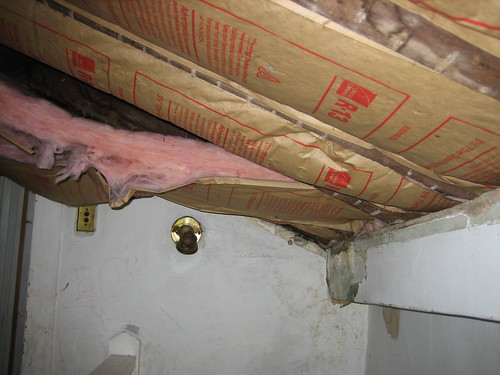
Basement
Photo by Laura Howard

On numerous occasions, I've been asked to help figure out how old this or that house is. More often than not, these questions come from the residents themselves. While it is possible to learn quite a bit from historical records, this can require specialized knowledge and still leave one with only a range of dates.

Homeowners (and other residents) are in a unique position to help date a structure - they have full access to the house, and can learn everything that the structure might tell them.

5856 Pearl Road
Photo by Laura Howard

Today, I will illustrate what we can learn from the physical evidence present at 5856 Pearl Road, in Parma Heights, Ohio. This historic home was photographed by Laura Howard, about a year and a half ago, and she was kind enough to share the photographs with me.

South wing
Photo by Laura Howard

The oldest part of the house, the southwest wing, is said to have been built by Oliver Emerson in 1831.

The exterior has been heavily modified. Other than the basic proportions, little original detail remains to be seen here. The original wood siding has been covered by asbestos shingles, and the window openings have likely been moved. Dormers have been added to the center wing of the house. The location of the center window on the second floor is likely original, but beyond that, I can't be sure of much without further physical investigation.

Foundation, south wing
Photo by Laura Howard

The one spot where the wood siding is exposed, alas, does not provide much detail for us to work with. Likewise the foundation, which appears to be made of material consistent with the suggested date, is sufficiently concealed that we can't learn much. There isn't a basement under this portion of the house, which is consistent with an earlier construction date.

Wood paneling, south wing
Photo by Laura Howard

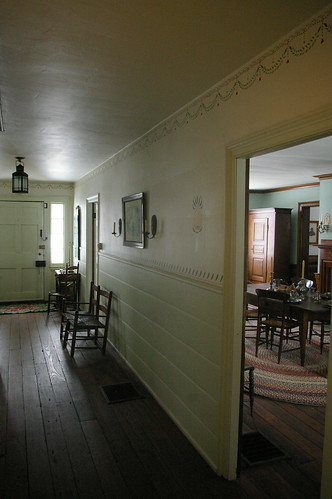
Inside this part of the house, the north wall includes this wood paneling.

Front hall

It is consistent with the paneling installed in the front hall of the Dunham Tavern. It's unclear whether this was installed at the time of construction or later. This could be determined by the careful removal of said paneling - if there is evidence of plaster underneath, it would indicate that the wood was added later.

The wide, thick floors, without use of subflooring would also tend to be indicative of an earlier date of construction.

The house retains a central fireplace. Unfortunately, it appears to have been modified so extensively that I can't tell much about it. I suspect that underneath the current brick may be the original fireplace. If this is, in fact, the case, this would tend toward indicating an early construction date, as with time and wood stoves, the trend was toward fireplaces on the ends of the structure.

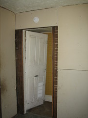
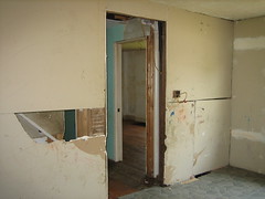
Basement door, between south and center wing Doorway between south and center wings
Photos by Laura Howard

The wall between the south and center parts of the house has been covered with drywall, concealing or eliminating much of the structural evidence. The door on the left, to the basement, is consistent in style with something built in the middle third of the 19th century, but beyond that, it's hard to be sure. It could be later, too.

If we look at the doorframe on the left, we can see, on the right side, the horizontal white lines where the plaster spread through the lath. At the bottom, there is an area that is free of such markings, suggesting that wood paneling may have been present originally.

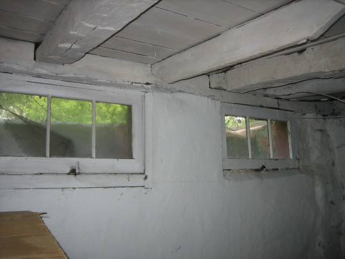
Basement
Photos by Laura Howard

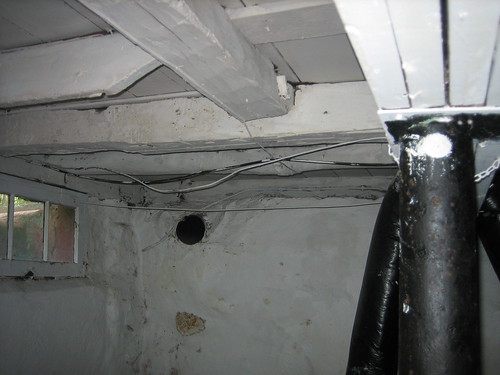
The center part of the house reveals more detail. In this photo of the basement, as well as in the lead photo, we can see hand-hewn timbers, indicative of a very early construction date. Cutting lumber was incredibly labor-intensive, and sawmills were set up anywhere that there was sufficient water to operate them. As a result, hand-hewn timbers are indicative of some of the earliest houses in the region. Further, as this part of the structure is one of the most difficult elements to change, this can help us date a house even when much of the original detail is missing.

One might also note that the subflooring (or possibly flooring) appears smooth in this image, suggesting that it was either replaced, or that the hand-hewn timbers we see here were reused from another structure. Note also the various shapes the timbers were hewn into.

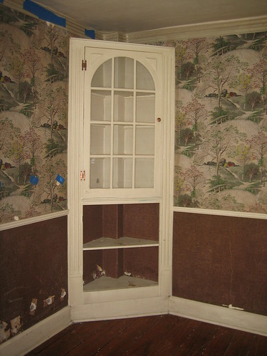
Corner cupboard, center wing
Photo by Laura Howard

On the first floor of the main wing, at one of the front corners is this corner cupboard, probably added circa 1910-1930. Behind it, we can see a structural timber, which would not have been common in a later structure.

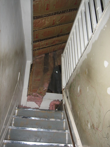
Stairs
Photo by Laura Howard

The stairs to the second floor reveal more structural details. We can see the outlines of the structural timbers that make up the top of the wall and the corner. We can also see a line on the wall, above the stairs, at a steeper angle than the stairs currently have. I found this rather suspect.

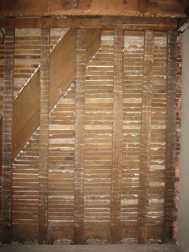
Wall and stringer, center wing
Photo by Laura Howard

This photograph, of the wall opposite the right side of the stairs, helps reveal what we see here. The steeper diagonal lines are the original stringers - the structural boards that make up the sides of the stairs. Why they were left in when the staircase was rebuilt at a more comfortable angle is unclear. This photo provides a closer detail of the structure.

Detail of paneling, center wing
Photo by Laura Howard

This view, at the bottom of the stairs, on the same wall, suggests that there was wood paneling, similar to what is visible in the older part of the house, that may have been concealed by drywall or plaster.

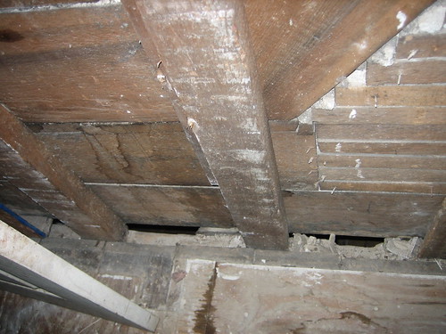
Detail, top of stairs
Photo by Laura Howard

Here, at the top of the stairs, we can see with more detail the massive timbers that make up the frame of the house.


There are many more details that I've omitted simply because I lack the information or detail to make full sense of them.

How old is this house? It's hard to say. It's believable that some part of the physical fabric dates to 1831, but how much is unclear. There's still a lot of research to be done in the history of buildings in this area.

If you have a house with structural hand-hewn timbers, please let me know. I'd be interested in better documenting and understanding the construction methods. It would help increase our knowledge of the early history of northeast Ohio.

Monday, August 23, 2010

How you can help

I've often been asked by individuals how they can help in the efforts to preserve local history. Here's one way.

Are there individuals of local historical importance that you admire or who interest you? Check to see if there's a biography of them in the library. Perhaps the biography will mention where they lived or did their most important work.

If so, keep an eye on those locations. If they seem threatened, email us as soon as you can. If you've got photographs or background information, so much the better.

The City of Cleveland is in the process of demolishing a large number of vacant homes. If we don't all act now, it will likely be too late.

Friday, July 23, 2010

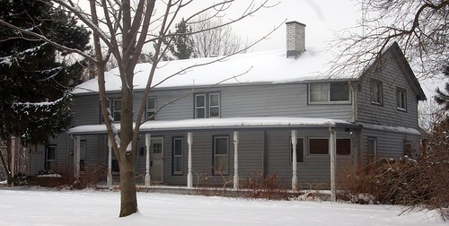
Five Buildings I Don't Know Anything About

The case of the Brainard residence brougth to my attention that I need to do something to address the buildings that I simply haven't been able to learn much about. Some of these are historic building for which my research has just been fruitless - in the past, I've refrained from posting about them, because I know you want good content, not just "This is an interesting building, but, um, I couldn't find anything about it in my various research sources." Others, I simply haven't had time to look into, and may deal with in depth in the future.
Old house on Neff Road
17206 Neff Road, Cleveland, Ohio

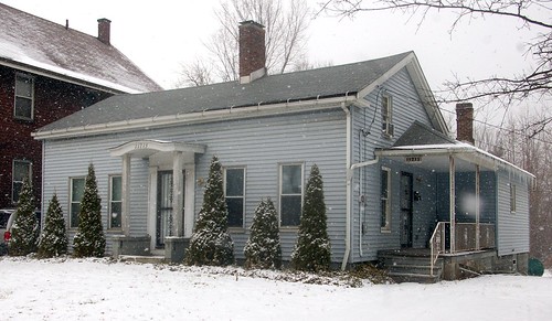
This large house appears to have been built in the middle third of the 19th century. I can't be much more sure about a date than that. It is part of Wildwood Park, which is part of Cleveland Lakfront State Park. I'm unclear as to whether it is owned by the city or state.

Given the size, it has the appearance of having been a tavern or inn, but other than proportions, I have no justification for this claim. A house was present on this site in 1858, belonging to one P. Banhard or P. Bankard, but I do not know for sure that this structure was the house in question.

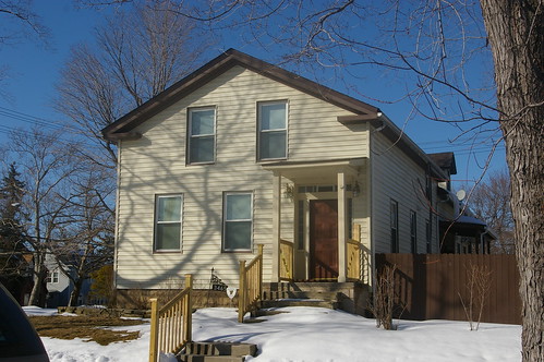
Greek Revival house
3465 Silsby Road, Cleveland Heights, Ohio

This nicely proportioned Greek Revival style farmhouse sits at the corner of Taylor and Silsby. One might miss it while driving by, because it faces Silsby rather than Taylor. It retains the original sidelights and transom surrounding the front door.

Update (August 10, 2010): This was the Frederick Silsby residence, as noted below by Kara Hamley O'Donnell.

Mid-19th century house
4321 East 71st Street, Cleveland, Ohio

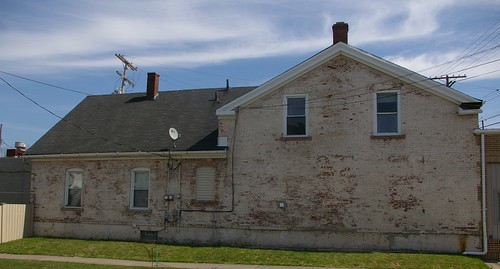
This house shares similar proportions to the Brainard residence and to 4216 East 93rd Street. If I had to guess, I'd say it was built circa 1850.

Brick house
5619 Harvard Avenue, Cleveland, Ohio

This brick house has had a storefront added to it, which is cropped out in this picture. The more shallow pitch of the roof make me think the date might be closer to 1840 than 1850, but it could be a bit later than that, too.

Greek Revival house
11715 Miles Avenue, Cleveland, Ohio.

Finally, this little house on Miles is surely worthy of more research. It's thought by some to be quite old - perhaps as early as 1830, though I'm not sure I want to be quite that optimistic. It will surely make for a good narrative at some future date.

Wednesday, June 9, 2010

Cleveland Heights Heritage Home Tour archives

Ceruti residence

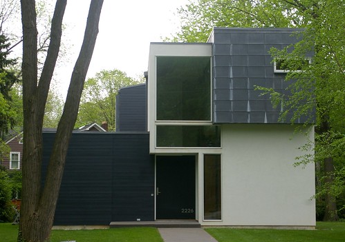
The other day, while I was trying to identify the architect for this house, at 2226 Chestnut Hills Drive, in Cleveland Heights, Ohio, I came across a great resource: the Cleveland Heights Heritage Home Tour. The tour is a project of the Cleveland Heights Historical Society, which has run the tour annually since 1977.

The website includes 229 homes. One may sort by street, year of construction, and year that the house appeared on the tour. Each entry includes a considerable amount of background information about the house. This includes the architects who designed the structures and the families who commissioned them. Further, the entries usually describe the interior, which is especially useful, as most sources tend to focus on the exteriors of these historic buildings.

It's worth noting, as the above photograph suggests, that the home tour includes both historic and contemporary architecture of interest. I learned, thanks to the database, that this house, built in 2005, was designed by architect Thom Stauffer. It's worth noting that the house was also featured in the 2007 Cleveland Artists Foundation exhibit Cleveland Goes Modern.

This brochure on Cleveland Heights Landmarks may also be of interest. It provides a brief overview of some of the most interesting structures in the city, including many commerical and religious structures not included in the tour.

Monday, April 19, 2010

Fort Huntington

Fort Huntington Park

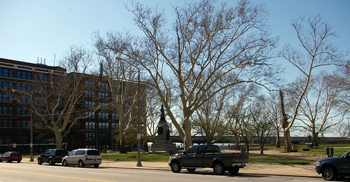
Have you ever driven past this park on Lakeside Avenue in downtown Cleveland, between Ontario and West 3rd Street?

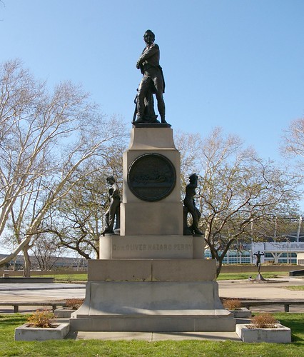
Oliver Hazard Perry memorial

You probably noticed this statue, erected to the memory of Commodore Oliver Hazard Perry and the role he played in the defense of the United States in the Battle of Lake Erie, during the War of 1812. A brief inscription on the reverse describes his accomplishment. This is not just another statue in a city park - this site is significant.

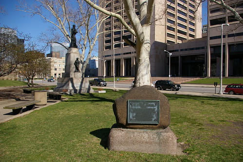
Fort Huntington historical marker

Near the Perry statue is a historical marker, identifying this land as part of Fort Huntington. The text reads:

Near this site Fort Huntington was erected by Captain Stanton Sholes' Company May, 1813.

On June 19, 1813, a part of the British fleet appeared off the fort but was drived away by a storm and no attack was made. General William Henry Harrison and the staff inspected the fort July, 1813.

Erected by the National Society United States Daughters of 1812, Commodore Perry Chapter, Cleveland, Ohio.

Marked on the 125th anniversary of the founding of Cleveland, A.D. 1921. Hon. W.S. Fitzgerald, mayor.


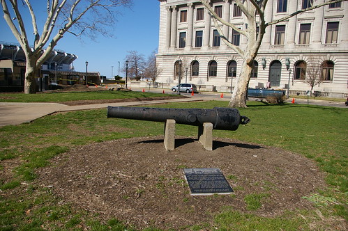
War of 1812 cannon

A canon captured from the British fleet during the Battle of Lake Erie has been placed nearby.

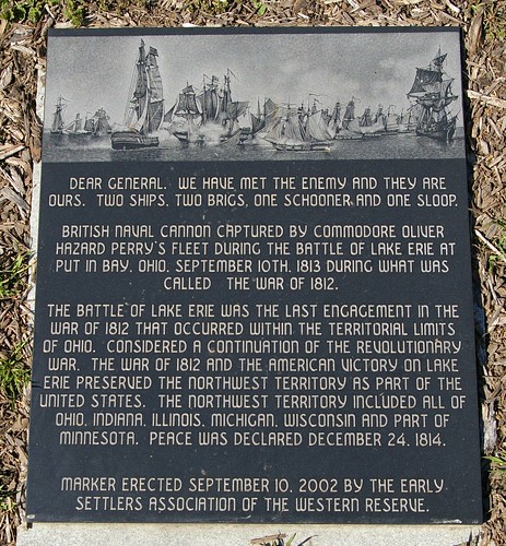
Oliver Hazard Perry memorial

The cannon is accompanied by this stone marker, installed in 2002 by the Early Settlers Association of the Western Reserve, describing its history and the significance of the Battle of Lake Erie and the War of 1812.

Another marker, erected on the Navy Bicentennial, in 1975, also commemorates the Battle of Lake Erie. Nearby stands a statue of Jesse Owens. The park also contains a memorial to the Cleveland Peace Officers who died in the line of duty.

So while this park may seem like just another city park, filled with monuments to various persons and groups, it is more than that. It is the site of Fort Huntington, a garrison built to defend this settlement from foreign invasion.

Monday, April 5, 2010

Historic photos of your house!

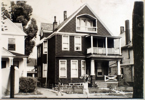
107-17-021
House on Kenmore Road - demolished

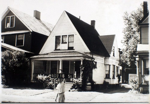
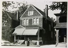
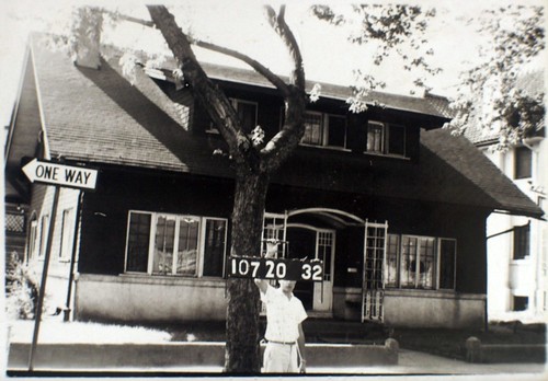
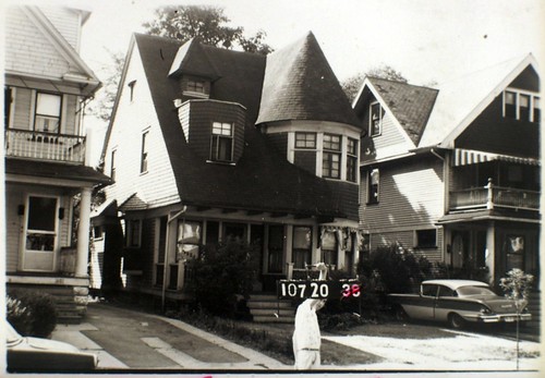
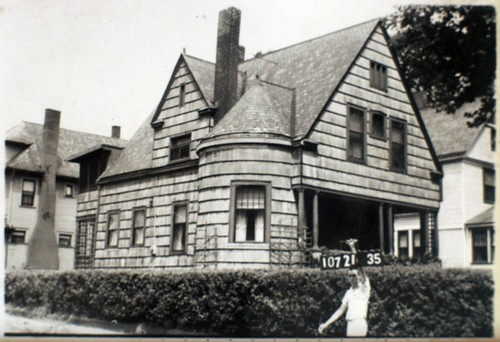
In the 1950s, the precedessors to the Cuyahoga County Auditor went through the county and photographed every single house, for tax valuation purposes. These photographs, about 1.5" x 2.25", were glued onto cards that described the size of the property, its amenities, and condition. At some point, these cards were transferred to the Cuyahoga County Archives, on Franlin Avenue, in Ohio City.
Not every card is present. Some are missing, and on some, the photographs have fallen off. Still, they are a valuable record of the built environment of this area.

107-18-056
8706 Harkness Road, Cleveland, Ohio - standing

A few months back, I went to the County Archives to research my own house. While I was there, I started looking through the photographs of the Hough area, where I work. I put my camera on a tripod, used a piece of cardboard to line up the photographs so that I didn't have to keep looking through the viewfinder, and started photographing them. In the space of two and a half hours, I was able to photograph about 330 of them. This is the result.

The photographs were grainy to begin with. A six megapixel digital camera captures virtually all of the information present in the original photograph. A little bit of post-processing, and they're ready to share.

If you do make it down to the Archives, it's worth taking the time to look at your neighbor's houses, too. The property cards are in order of parcel number, so you should verify your neighbor's parcel numbers beforehand - they aren't necessarily numbered sequentially with yours.

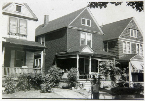
119-30-066

As an example, take this, the house that Langston Hughes lived in during his sophomore and junior years of high school, from 1917 to 1919. It is located at 2266 East 86th Street, in the Fairfax neighborhood of Cleveland. It has recently been nominated as a Cleveland Landmark. The Fairfax Renaissance Development Corp. is in the process of rehabilitating it.

119-30-065 119-29-041

Now look at the photos of the houses of his neighbors, to the south and north, respectively. These photographs reveal parts of the Langston Hughes house not shown in the photo for 2266 East 86th Street.

107-20-032

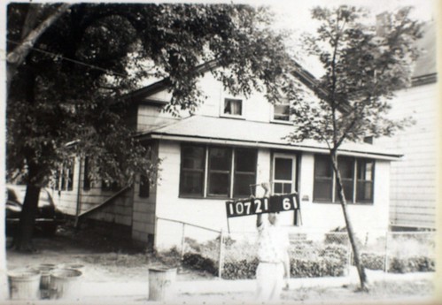
Each photograph includes someone holding a sign that displays the parcel number of the house in question, as shown here, at 1621 Holyrood Road. This is quite helpful. It makes it possible to just digitize the photographs, without having to record the caption information. It's also quite helpful when photographs have become unglued from the property cards - it makes it possible to figure out which card they ought to be reattached to.

These images can be especially useful in the cases like this house, where exterior modifications have been significant. They are also quite useful in a neighborhood like Hough, where at least half the houses present in the mid-1950s have been demolished. These photographs can help paint a picture of the neighborhood as it was. You can use a set of photographs to document what a whole block used to look like.

The following are a few of my favorites:

107-20-039
1627 Holyrood Avenue - Built in 1900 for Harold Randolph - standing

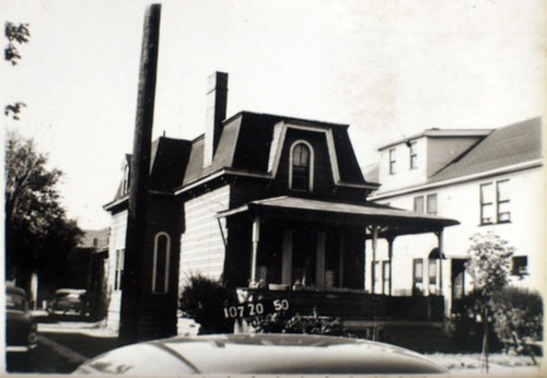
107-20-050
9214 Edmunds Avenue - demolished. The house appears to have been built in the 1870s, at 1861 East 90th Street. It was moved to this site in 1909. An apartment building was built at the location on East 90th Street shortly after.

107-21-035
1618 Ansel Road - standing. The house was built in 1892 for George Richardson, a local real estate developer. It was sold soon after to Elah French, who lived in it with his wife Adelaide.

107-21-061
Parcel 107-21-061 - demolished. A nice, little Greek Revival farmhouse.

I would love to see more of these photographs digitized. There's no way any individual could possibly do this. However, if we were to each photograph some, we could eventually achieve this goal.

Thursday, April 1, 2010

Lustron: The House America's Been Waiting For

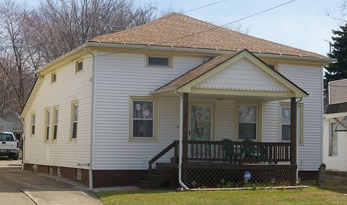
Lustron house

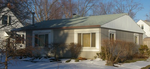
The Lustron house was a prefabricated enameled steel house made in Columbus, Ohio, between 1948 and 1950. The design was an attempt to repurpose factories left from the war effort and to address the post-war housing crisis. Approximately 2000 were made. Many were built in the Cleveland area.

Lustron house

All of the major component parts were made from steel - including the roof. Sadly, most have not held up as well as this model, at 695 McKinley Avenue, in Bedford, Ohio. Even it, however, has recently had replacement windows installed.

This house, documented by the Historic American Buildings Survey, provides some idea as to the original appearance of the interior. The rooms featured built in closets and cabinets, which provided greater use of the available floorspace.

Lustron house

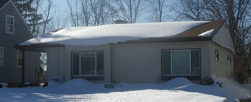
Four choices of exterior colors were available: blue, yellow, tan, and gray. Due to changing tastes, more than half of the Lustron houses in this area have since been vinyl-sided, such as this one, at 1517 Crestwood Road, in Mayfield Heights, Ohio. It seems likely that this is more the result of changes in taste than anything else - I have not seen one bit of rust on any of these houses, and if rust was such a problem that some owners vinyl-sided their houses to conceal it, it would surely show up to some extent those not vinyl-sided.

The roof, too, has been covered with asphalt shingles. It is not clear whether this was done to remedy a problem or due to changes in taste. It seems that a greater percentage of these houses have new roofs than have vinyl siding.

Lustron house
Many of the interiors have remained the same, as the steel structure makes them difficult to change. This one, however, at 1024 Mayfield Ridge Road, in Mayfield Heights, Ohio, has changed quite a bit. It is currently listed for sale by owner. The listing provides a detailed view of the interior.

These houses represent a significant point in our industrial growth and movement to the suburbs. The first enamel-steel house was built in South Euclid, by Ferro Corp. Later work in this field was based on that house.

Should we try to preserve all of these houses? No. We should work to preserve the best examples. One example would be this one, on Mastick Road in North Olmsted. It retains most of the original exterior details and looks quite sharp.

Further, we should identify all of the extant Lustron houses, so that if one is to be demolished, some of the parts, which are quite difficult to find, may be reused in other Lustron homes. Lustron Preservation has a database mapping all the known Lustrons, which provides a great deal of assistance, to that end.