Showing posts with label history. Show all posts

Tuesday, October 11, 2011

Decades in the Making

Repairing the Stairs on the Wade Park Bridge

Wade Park Avenue Bridge

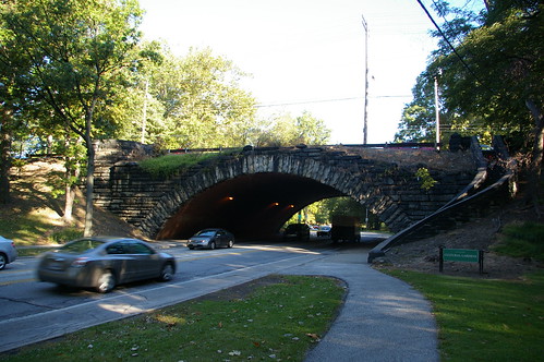
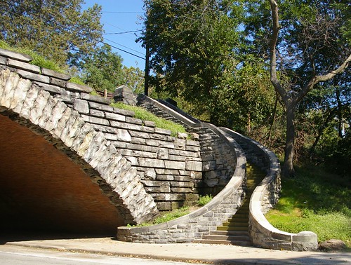
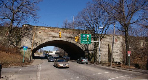
In 1899, Charles Schweinfurth designed this bridge, carrying Wade Park Avenue over what is now Martin Luther King, Jr. Boulevard. It's one of four bridges he designed for the park between 1896 and 1899. This is often cited as the most impressive of the lot. For decades the stairs, allowing pedestrians access to the park, have been closed, too damaged to safely use.

Wade Park Avenue Bridge

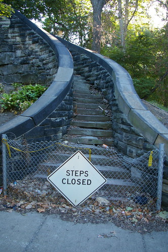
This was the sign greeting pedestrians back in September, when I demanded Repair the Stairs on the Wade Park Bridge!

Guess what? Here's a hint:

Wade Park Avenue Bridge

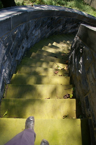
Note: if Cleveland Area History was a glossy, high-production magazine, the photograph would be from the boulevard, and feature several people, skipping down the stairs, gauze flowing in the breeze behind them. But it's not, so you'll have to deal with my feet.

Wade Park Avenue Bridge

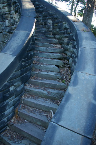
Was that not clear enough? This perspective should be more illuminating - the stairs have been fixed!

I confess, when I first drove by and saw the green hue of the stairs, I grumbled to my self. At 35 miles per hour, the green looked an awful lot like the hue of freshly poured cement. "Great," I thought, "someone took the cheap way out, rather than replacing the sandstone with sandstone, as they should have."

Stairs, Wade Park Avenue Bridge

I was wrong.

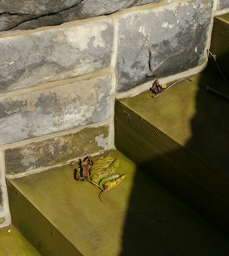
They did, in fact, do the work with proper materials. It's just that the new sandstone has a very different hue from the old sandstone. Perhaps it will fade to match the existing stone.

The project was sponsored by the Holden Parks Trust. The architects were Chambers, Murphy, & Burge. The contractor was M-A Building & Maintenance Co.

Repairing the stairs on the Wade Park Avenue Bridge Repairing the stairs on the Wade Park Avenue Bridge

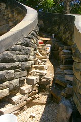
Photographs taken in July, while the project was in progress, should illuminate the original construction methods used on this stairway. (I'm always interested in seeing how historic structures were built - it's an underdocumented subject area, and it can be useful in dating structures where the year of construction is unknown.) That said, I'm not sure quite what these images tell us.


This is but one example of the progress that we're making with historic preservation in Cleveland. More will follow in coming weeks.

Tuesday, October 5, 2010

The New Cuyahoga: A Proposal to Straighten the "Crooked River"

The name Cuyahoga is said to mean "Crooked River". Yet in the 1910s, there was a proposal to straighten the river, The New Cuyahoga: River Straightening Recommendations. This document was brought to my attention by Kevin Leeson, of the Cuyahoga County Planning Commission. The book is reproduced here from a copy in their collections, with the exception of the map below, which is used courtesy of Special Collections, Cleveland State University.


Image used courtesy of the Cleveland Memory Project, Michael Schwartz Library, Cleveland State University

The publication includes this folded map. (Note: a higher resolution version, as well as other maps of the river, are available as part of the Cuyahoga River Online Exhibition.) The blue represents the current course of the river, while the red represents the proposed realignment. Why would the Committee on River and Harbor Improvement of the Cleveland Chamber of Commerce, the author, suggest this? Why would they suggest the drastic change to something that was for a long time, one of the more graphically recognizable elements of our city?

In short, commerce. The report suggests that the difficulty of navigating the river made shipping to and from Cleveland more expensive, putting the port at a commercial disadvantage. Further, it was said that the project would provide relief from the flooding of the Flats, as had happened in 1904 and 1913. It suggests that the money saved by preventing floods would cover the cost of the river realignment. The authors add that it would open part of the upper Cuyahoga to industrial development.

A 1919 report, Conservancy and the Cuyahoga continues on the same train of thought.

It's unclear why these proposals remained mere proposals. The shape of the river remains an important part of Cleveland's history - from its founding to industrial growth to now, when we're using it for recreation - it's even a part of the Cleveland Area History logo.

There's no mention as to whether they planned to change the name of the river, once it was no longer "crooked".

Monday, October 4, 2010

Condemned Cleveland: A House on South Boulevard

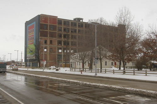
House in Wade Park neighborhood

A little while ago, I shared the list of structures condemened by the city of Cleveland in the past six months. I've been going through the list as I'm able, identifying the structures I that appear to be most historically or architecturally important.

It's a lot of structures. As of right now, the number is about 1200. And it's an imperfect science - I'm using Google Street View and Bing Maps to see what I can - but this is limited. Yes, I'd prefer to actually set my eyes on these properties, but I simply don't have the time. Further, I don't have a good list of which properties might be important for what happened in them.

Take a look at the list. See if there's anything in your neighborhood that you think is important. If you can get me photos of them, it would be much appreciated.


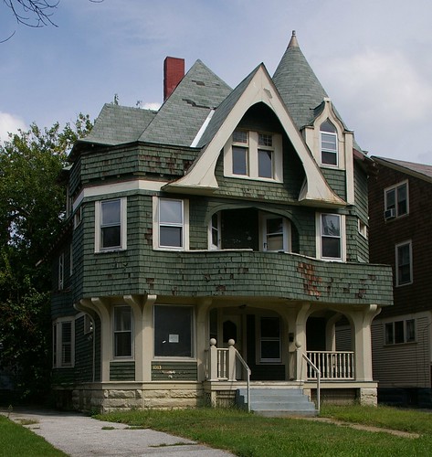
The lead photo is of 10113 South Boulevard, Cleveland, Ohio. It's one of the more interesting houses in the East Boulevard / Wade Park area - a neighborhood of eclectic homes. I wrote a story on it back in November - this was one of the houses included in that story.

The property was sold at Sheriff's Sale in July, 2008, to the mortgage holder, Wells Fargo Bank. Property taxes appear to not have been paid since that time. In December of that year, it was sold to the current owner, Ez Access Funding, LLC.

EZ Access Funding owns more than 70 properties within the city of Cleveland. As of September 30, they have been prohibited from transferring any property in Cleveland, for their failure to appear in court. (AFN: 201009300961)

EZ Access Funding, LLC is registered in California. Its mailing address is listed (by the California Secretary of State) as 3920 Birch Street, Suite 105, Newport Beach, CA, 92660. Their contact agent is one Marc R. Tow, a lawyer, whose mailing address is 3900 Birch Street, Suite 102, also in Newport Beach. Their phone numbers are 949-419-9093 and 949-975-0544, respectively.

This would be the same EZ Access funding who owns the house that exploded on West 83rd Street. Bill Callahan discusses their questionable business dealings in much more detail. Marc Tow / EZ Access were scheduled to appear in Housing Court back in February, to address several matters, including almost $100,000 in back taxes and an outstanding warrant, but to no one's surprise, they did not appear.

How much damage must an individual do before we can justify the cost of sending a bailiff cross country to serve them? Surely there must be something that we can do to address parties who, through apparent negligence, damage the historic structure of our communities and diminish our tax base.


This beautiful turn of the century house deserves a better owner. The architectural character contributes to the historic nature of the neighborhood.

East Boulevard is a great neighborhood - and I'm not just saying this because I work in it (at the Langston Hughes Branch of Cleveland Public Library). Surely this property could be sold at sheriff's sale to the city land bank - and then to the new owner - if there was someone interested in fixing it up. It's a great property - perhaps you are that person?

Check in on Wednesday for the next article in this series. Until then, take a look at the list and see if there is anything that catches your eye.

Update: October 5, 2010: I looked in the first floor windows. Through the front door, you can see a fireplace with built in benches on either side. To the left, one can see a doorway with a pair of pocket doors. To the right, just inside the door, is a small built-in bench. Next to it, the stairs up the the second floor. The woodwork is beautiful. It's the cleanest condemned house I've yet seen.

There are a few liabilities. I saw some damage to the plaster by the pocket doors (looked more like vandalism than a search for plumbing). The kitchen was a rather boring replacement - but in decent condition. The exterior did show some water issues, which appeared to be due to the lack of gutters and downspouts on the structure.

Monday, September 27, 2010

Euclid Avenue: What We've Lost and What We Will Probably Lose

Demolition on Euclid Avenue

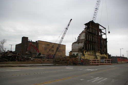
Cleveland's Euclid Avenue isn't the main thoroughfare that it once was. Most of the grand homes that once graced it are now long gone. However, in conjunction with the creation of the Health Line, much has been lost. More of the historic fabric will be gone, if we don't act soon, just like the historic Cobb & Bradley building, shown here.

This post is an attempt to identify what we've lost (or may lose) along Euclid Avenue. It focuses on historic buildings that have been lost in the past couple years, or, in the case of structures still standing, those that face immediate danger. Are all of these great architecture? Perhaps not - but they contribute to the streetscape and to the shape of our community.

Our journey will begin east from downtown Cleveland.

Photo by Keri Zipay

The terra-cotta-faced Cleveland Cadillac Building, at 1935 Euclid Avenue was built in 1914. Knox and Elliott were the architects. It was demolished by Cleveland State University to make way for expansion.

The Student Center at Cleveland State University, designed by Don Hisaka was also demolished, to make way for another structure serving the same purpose. Many said that the structure as it was was utterly unusable. Perhaps it was. How do you deal with a visually stunning structure when it doesn't do the job it's supposed to do?

IMG_1599.JPG
Photo by Pavel Dyban

This group of four buildings were located on the south side of the street, immediately east of the train tracks and East 55th Street. They have all been demolished. When the photo was taken, it seems that an additional building, immediately to the east, had been recently demolished. The third building over appears, based on the lack of windows, to have been some sort of secure storage facility.

Cobb & Bradley Building
Photo by Otterphoto

The Cobb and Bradley building was on the north side of the street, between the trestle and East 57th Street. The late 19th century architectural detail is more of an earlier era than most of what was present on this part of Euclid Avenue. It was demolished in April of 2009.

Cobb & Bradley Building
Photo by Otterphoto

Immediately to the east lay this apartment building, which was demolished at the same time. It's interesting that most of the copper detail around the roof still remained when this photo was taken.

Another building was present on the north side of Euclid Avenue, between East 57th and East 59th Streets, but I have been unable to locate a photo of the structure.

IMG_1600.JPG
Photo by Pavel Dyban

Of the three commerical / industrial buildings photographed here by Pavel Dyban in November, 2005, during his cross-country road trip, only one survives. The block looks like a single building, but is actually three. The rear part, as well as the building closer to us have both been demolished.

IMG_1601.JPG
Photo by Pavel Dyban

The remaining structure looks somewhat naked. The façade of 6611 Euclid was removed when the road was widened, to accompany a turn lane (as was required) when the Health Line was built. Another building, also now lost to history, stood adjacent to the east.

Continuing east on the north side of the street is the Dunham Tavern, the oldest structure on its original foundation in the city.

IMG_1602.JPG
Photo by Pavel Dyban

Immediately east of the Dunham Tavern, at the northeast corner of Euclid and East 69th Street was this two-story commercial structure, which has been demolished.

Two Dollar Rare Book Store

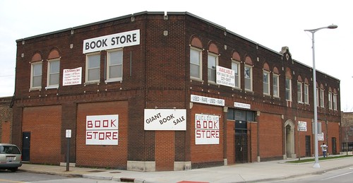
Immediately opposite, on the south side of Euclid Avenue, sat the two story brick building that housed The Two Dollar Rare Book Store. While the building itself was relatively undistinguished, the bookstore was phenomenal. I've never seen so many great books at such reasonable prices. Chris Uram, the owner, took in the books that other book dealers wouldn't touch, because they were often in such poor condition. He offered them at bargain prices. Hundreds of them made their way to my house. I do hope that he is able to relocate.

Eton and Rugby Hall apartments

The Eton and Rugby Hall Apartments, at 7338 Euclid Avenue, were built 1925. George Allen Grieble was the architect. These buildings, with their beautiful terra cotta details have been vacant for at least 30 years. They will be demolished soon to make way for low-income senior housing.

Cleveland Play House

The Cleveland Play House was remodeled in 1983 by Philip Johnson, the architect best known for his 1949 Glass House, a National Historic Landmark, in New Canaan, Connecticut. Johnson is a Clevelander, and this is the only building by him in this city.

The structure has been purchased by the Cleveland Clinic. While they have not yet revealed their plans for the structure, I strongly suspect, given their track record, that it will be demolished.

Euclid Avenue Congregational Church

Euclid Avenue Congregational Church 9606 Euclid Avenue, was built in 1884-1887. The architects were Coburn and Barnum. It was demolished, following a fire caused by a lightning strike in the early hours of Tuesday, March 23.

Hathaway Brown II
Photo by Thom Sheridan

The original Hathaway Brown School building, on the north side of Euclid Avenue, at East 97th Street, was designed by architects Hubbell and Benes in 1905. It was demolished in January by the Cleveland Clinic.

Laurel School

The original Laurel School building had been connected to the Hathaway Brown structure, and was demolished at the same time.


Were these buildings too far gone to be saved? For some, the answer is yes. Others could have been easily reused if the owners had chosen to. There's one, however, that I believe should be saved.

It's been defaced, as I indicated above, and what remains isn't terribly architecturally distinguished. That doesn't stop it from being important.

Dunham Tavern

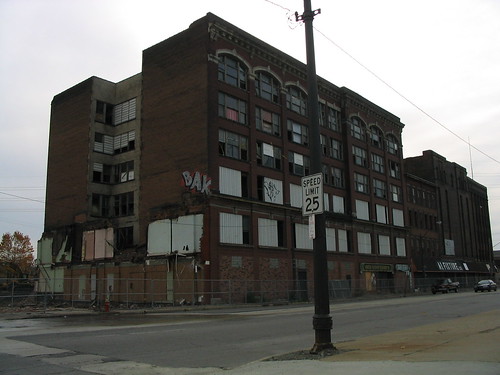
6611 Euclid, the tall industrial building standing here next to the Dunham Tavern, provides real context for the museum. It illustrates how the city grew up around this tavern, and the level of development threats faced by it. It hints at how close the tavern might have come to being demolished itself.

This historic structure, 6611 Euclid Avenue, was condemned on May 7. Do we want another vacant lot, or do we want something that contributes significantly to the Dunham Tavern Museum?

It's the last of the taller structures of its type along Euclid Avenue, between East 55th and East 105th Streets. Once it is gone, this context will be lost forever. The building is owned by the RTA - in other words, us. We need to make the right decision here.

Friday, September 24, 2010

Which Cleveland structures have been condemned?

One of the issues we face in the field of historic preservation is simply identifying the properties that are most threatened. Some threats include neglect, redevelopment, and vandalism. Here, right now, the greatest threat is from the Cleveland Department of Building and Housing, in the form of demolition used as a tool to abate housing code violations.

How and why may a property be condemned? When there is probable cause, a housing inspector may obtain a warrant and search a structure for code violations. If the violations are severe enough, a condemnation notice will be issued, listing the violations - see the Stanley Block for an example. This gives the property owner a period of time, usually 30 days, to fix the violations or appeal. If the owner fails to respond or comply within the given time, the case goes to the Law Department, who reviews the case and then forwards the file to Department of Building and Housing's Demolition Bureau. The Demolition Bureau requests bids and selects a demolition contractor. Once the demolition is complete, the city bills the owner for the cost of demolition.

A condemnation notice doesn't mean that the structure will be demolished. A property owner may elect to fix the violations. It is, however, the first step on that route, and therefore, the best time to act. The problem is knowing which historic structures have been condemned.

The only public notice currently provided are signs stapled to the exterior of the structures. These are often removed or fall off. While one can keep track of a few important properties, and others will notice some, as was the case where one of you let me know about the Frankie Yankovic boyhood home, this just isn't sufficient. It would be a massive, time-consuming task to identify all of these structures. We can do better.

To that end, I requested a list of the structures that had been condemned in the past six months from the Department of Building and Housing. I said that if that list wasn't available, I'd take whatever data they might have that would include the condemnations. I received this list. It lists all 1202 properties condemned between April 1 and September 21, 2010. Look at it. See if there are any that you know to be important.

Note: At present, one cannot sort the list by street. I had tried to split up the addresses so that this could be done, but for some reason, it led to errors in the column for type of condemnation. I will work on this. Update: October 4, 2010: the data can now be sorted by address. Also note that the two far right columns are my own notes. I'm trying to figure out which structures are important, both for history and aesthetics. As you can see, I need help.

A further note on my notes:
H = Historic
m = Maybe historic
n = Not obviously historic. May still be a very interesting house or have historic value not obvious on the surface - i.e. the residence of a famous person.
? = I can't see enough from the available aerial photos to make a judgement one way or the other.
i = Architecturally interesting. Not of major historic value, but of above average quality and probably worth preserving.


To better illustrate which structures have been condemned, I've used a map here to display the data. Which historic sites do you see?

Tuesday, September 14, 2010

Repair the Stairs on the Wade Park Bridge!

Bridge over MLK Boulevard

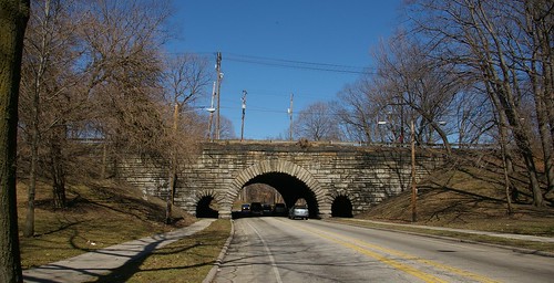
Charles Schweinfurth's four bridges over Martin Luther King, Jr. Boulevard in Rockefeller Park help to define the landscape. These stone structures, built from 1896-1899, help form the space into more of a park. While a cohesive group, each has its own style.

The most northern, built for the tracks of the Lake Shore & Michigan Railroad, provides a grand entrance to the park.

Bridge over MLK Boulevard

The St. Clair Avenue bridge, seen here from the south looking north, is monumental without being imposing.

Continuing south, the Superior Avenue bridge, completed in 1897, crosses at a bit of a diagonal relative to the road.

Wade Park Avenue Bridge

The most southern the bridge for Wade Park Avenue, was completed in 1899. The area at the top appears unfinished, allowing vegetation to spill over, providing the appearance of a grand ruin. Many consider it to be the best of the lot.

The significance was further illustrated by the decision of the Historic American Buildings Survey to document the bridge, in 1965. It's worth noting that they too chose to photograph the side of the bridge with the staircase, and that two of the four photographs focused on it.

Wade Park Avenue Bridge

Now, however, the stairs sit in a state of disrepair, closed to pedestrians, as they have been for several years. When the stairs were built, they connected the surrounding neighborhoods with this beautiful piece of parkland. At the turn of the century, walking in the parks was a popular leisure activity - unlike many other forms of entertainment, it didn't cost anything more than the streetcar fare to get there.

Wade Park Avenue Bridge

It appears that the problem is the deterioration of the sandstone that makes up the stairs themselves - the walls and rails on either side appear to be in decent condition. I would hope that this could be repaired without becoming a major construction project.


The bridge falls into Ward 8, which is represented by Jeffrey Johnson. His office seems an appropriate starting point for this request.

The parkway is used by many as a commuter artery. We should do what it takes to open it back up to the people who live closest to it.

Monday, September 13, 2010

Snapshots of Cleveland, 1910-1913

Group portrait 8b

Shortly after I purchased the ten glass plate negatives that I used in the series Cleveland in 1927, I purchased another group of photographs on eBay, one that I hope had similar promise.

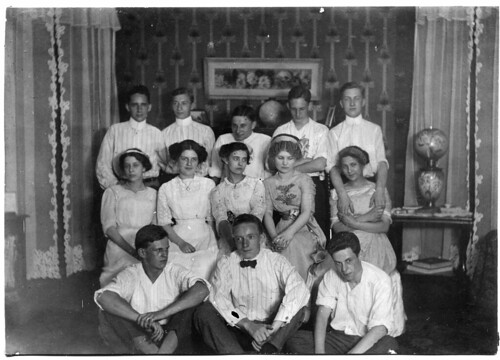
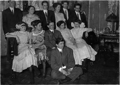
This group of 52 snapshots seem to have all been taken between 1910 and 1913. While an interesting collection, they don't feature the landmarks that make for easy identification. I've been able to assemble something of a narrative, but it doesn't seem to be a story that merits being spread out over several posts. I've shared the best of the lot here. I hope that if you find them interesting, you'll look at the full set. Perhaps you'll be able to illuminate more of the story.

I have omitted one photo. That photo will be our mystery photo for the week, to be published at 12:01 AM on Thursday. The first person to identify it will have their choice of our usual assortment of prizes.

As always, if you have a set of photographs like this and are willing to share them, please contact clevelandareahistory@gmail.com. If I deem that they'd make a good story, I'd be more than willing to scan them and do whatever research I can.


The following images are snapshots. They were scanned (and are presented) at 600 dpi. As snapshots, likely made with inexpensive cameras, the quality of the exposure of the originals varied considerably. I have adjusted the exposure as needed to provide the greatest possible level of detail.

The photos were removed from an album, prior to coming into my possession. They retain fragments of the adhesive corners used to hold them into the album.


Group portrait 13a

Many of the photos are group portraits. There are often two versions of the same composition. When so, I've labeled them as "a" and "b" to group them together. Some appear to have been more candid, or at least attempting to look more candid.
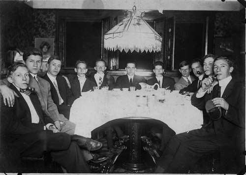
"at Stones"

This one features a group of young men, titled simply "at Stones".
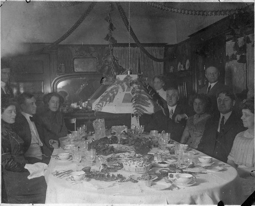
Holiday celebration

This one, from December 21, 1910, shows a family seated at a dining table for a holiday celebration.
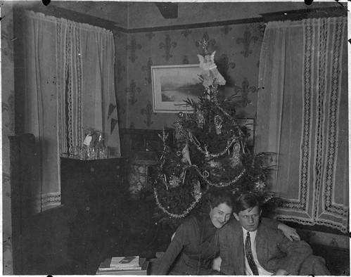
Christmas tree and a couple

One of the women from the preceding portrait is shown here with a companion, on Christmas Day, 1910.
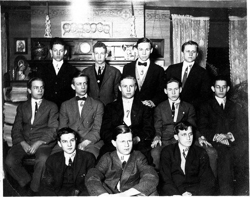
Alpha Chi Sigma

This group portrait was the one that got my attention. It shows the members of Alpha Chi Sigma, the fraternal organization for chemists, presumably the chapter at the Case School of Applied Sciences.

A key is provided on the back, listing the individuals in the photos. With some work, some of them may be identified in the other photos. From left to right, they are: (top row) Creighton Whitehead; Bob Snyder; John Madigan; Herbert Kortage; (middle row) Howard Rose; Walter Doxey; Ed Horr; James McCaslin; George Russel; (bottom row) Ordello Doty; [unknown]; and Clarence Vollman. It might be worth seeing where else these individuals appear in this group of photos, as well as seeing what they went on to accomplish. Many of the group are pictured in better detail here.
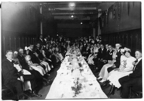
Formal dinner, possibly at East Tech

This is the last interior group photo I'll mention. It appears to be a formal dinner. Several pennants hang on the walls, including those for Harvard, Michigan, Chicago, and the Case School of Applied Sciences. Does anyone recogize the location?
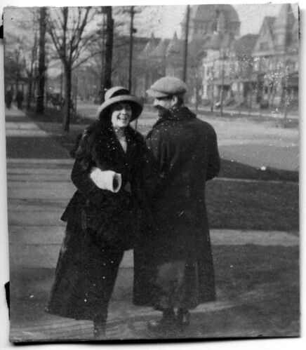
Portrait on East 55th

This couple appears to have been photographed on the west side of East 55th Street, probably near East Tech. The camera was pointed north. Temple Tifereth Israel (now Friendship Baptist Church), built 1894, Lehman and Schmitt, architects, can be seen in the background.
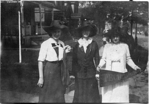
Three East Tech students

These three women appear to be East Tech students or recent graduates. They would likely have been in one of the first graduating classes, as the school opened in 1908. The location of the photo may have been on Sagamore Avenue.
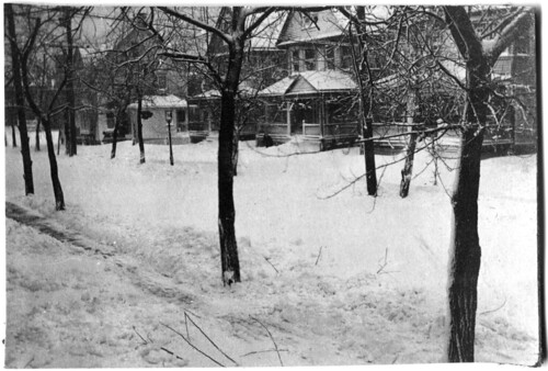
Looking east down Sagamore Avenue

This photo shows the view on the south side of Sagamore Avenue, in the winter of 1913.
7608 Sagamore Avenue Looking west down Sagamore Avenue

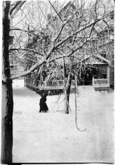
These two photos from that winter continue the panorama, with 7608 Sagamore Avenue and the houses to the east.
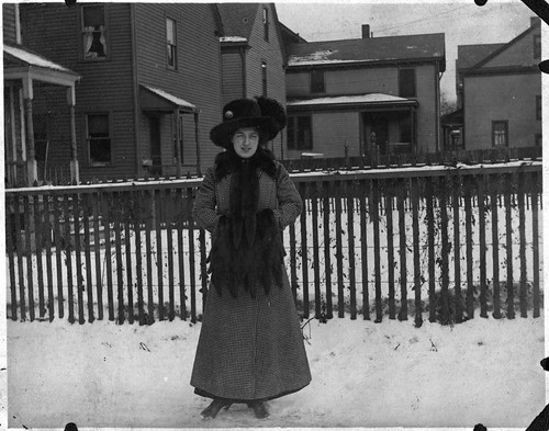
Christmas Day, 1910

This woman, who appears in several of the other photos, was photographed in the back yard of 7608 Sagamore, on Christmas Day, 1910. The rear portion of the house that is visible immediately to her left, 7702-7704 Sagamore, was moved to the site between 1903-1912, from the southwest corner of Sagamore and East 79th Street. The address, pre-1905, (and pre-move) was 968 East Madison.
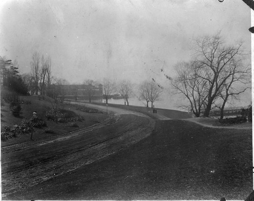
Gordon Park

The landscape of Gordon Park features prominently in several of the photos, many of which were taken in the winter. A structure that appears to be a bath house is visible in the background.
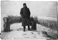
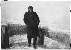
Winter portrait, on Lake Erie Winter portrait, on Lake Erie

These two portraits may have also been made at Gordon Park. The camera under the arm of the man on the right may have been the one used to take several of the other photos.
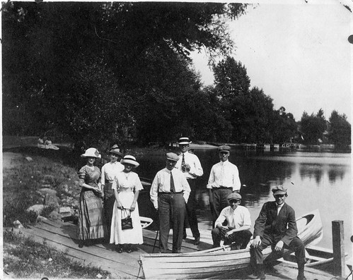
possibly Wade Park

This group may have been on an outing at the pond at Wade Park. I'm unsure as to the location, however. This group might have also been photographed in Wade Park.
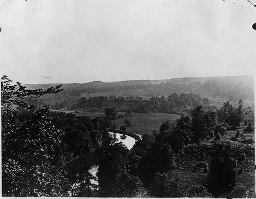
Camp

This photo was labeled "Camp". One guess as to the location would be the Cuyahoga Valley - but it could be any number of other locations as well.
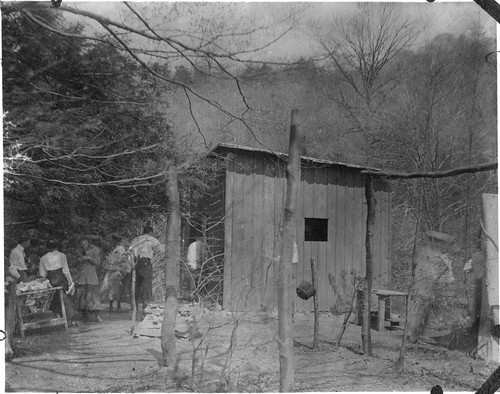
Camp

I would guess that this photo illustrates a campsite, given the presence of the tent to the right. The function of the building in the center is unclear. Another photograph also features it. It seems too large to be an outhouse.
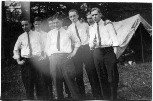
Group portrait in camp

This group appear to also be camping.
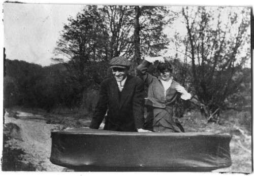
img001h

This couple was photographed facing backwards in a car. Two photographs of another woman were also taken in this location.
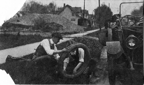
Changing a flat tire Changing a flat tire

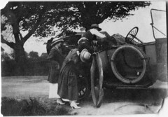
Here, we can see a flat tire being changed. Can anyone identify the automobile, or the curious steering wheel?
Repairing a flat tire

I believe that this is the same automobile, again with a flat tire, but in a more urban location.
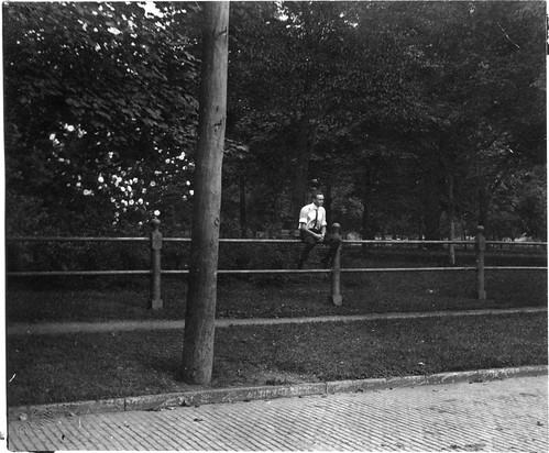
Man sitting on a fence

To close, I offer this photo, of a man sitting on a fence. It has bothered me, because it seems so familar, but yet I cannot place it. Does it seem familiar to you?


This collection provides a look into a group of upper middle class young men and women from about 1910-1913. It's an interesting little bit of Cleveland history. I look forward to seeing what you, the reader can add to this story.